The sky is the limit
October 21, 2018 · Insights
Drones. It seems like everyone is talking about them. But what’s the big deal? Are they actually more than a toy that allows people to become pilots with just a smart phone and remote control?
The answer is yes. There is much more to drones than inflight fun. They are a growing trend in the business world, specifically the AEC industry.
GMC has several departments using drone technology. With five FAA-certified drone operators, GMC goes to great effort to utilize the most current technologies to better serve our clients and remain ahead of the competition. Often, cutting edge technologies decrease cost, increase safety and provide a superior level of information. GMC employs rigorous processes to ensure that any new technology or technique that we offer to our clients is tested and meets the highest QA/QC standards.
As an option on appropriate projects, GMC offers the use of a professional mapping drone, which collects unmatched data and imaging.
Shawn Yuhasz is a professional land surveyor (PLS) in GMC’s Mobile office and one of the firm’s certified drone pilots. Shawn operates the senseFly eBee® drone, which is far more advanced than a hobby store Christmas toy. This high-tech machine can cover up to 4 square miles in a single automated flight, acquiring images with up to a ground sampling distance (GSD) of down to 1.5 cm (0.6 in) per pixel. The eBee’s high-resolution aerial images are transformed into a digital georeferenced orthoimage and point cloud. These, along with other outputs such as contour lines and 3D mesh, allow GMC to gather the most accurate and detailed data available, and to do it all in-house. Our FAA-certified remote pilots fly the drone; our technicians process the data; and our engineers, planners and architects design using the data. This saves time and cost synergies for our clients as well as limiting personnel exposure to active construction sites on busy airfields.
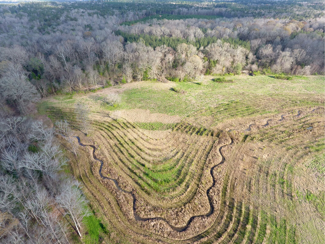
 GMC’s Environmental team has incorporated drone technology into several current environmental projects. The drone can provide real-time aerial 12-megapixel imagery and 4k video of the project, as opposed to waiting on Google Earth’s updates, allowing for faster, more accurate responses to project questions or issues. The team uses the DJI Phantom 4 drone for photography and videography, which allows the Environmental team to:
• monitor the progress of stream restorations during and post construction;
• present projects through phases of restoration;
• locate areas of stressed vegetation or patches of invasive species within the riparian buffer that would be otherwise difficult to see from the ground;
• view obstructions within restored channels (i.e., head cuts, beaver dams, etc.); and
• identify areas of concern before walking a project site to locate focus points.
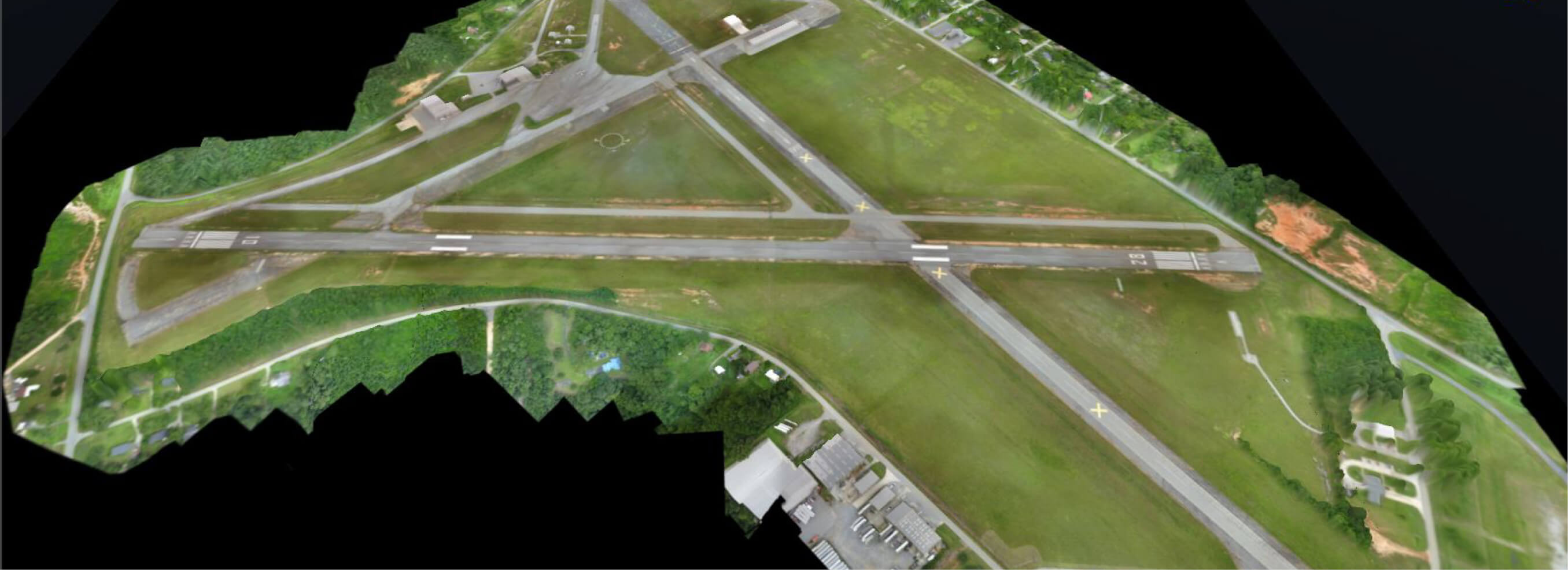
GMC has used drones in various ways for a diverse range of project types throughout our footprint. At the Lanett Municipal Airport Runway Realignment Project, drone technology was used to provide an existing grade surface for quantity calculations during construction, with eight flights being conducted between October 2017 and August 2018. A drone was used to conduct a tree canopy survey at the Statesboro-Bulloch County Airport in Georgia, which provided 3D-point cloud data to identify obstruction areas within runway approach zones.
For the Mobile Area Water & Sewer System Three Mile Creek Project, the project team utilized drone technology to obtain ground topographical data to incorporate with traditional survey data for the development of a ground surface model and provided up-to-date imagery of the site to assist in decision making going forward.
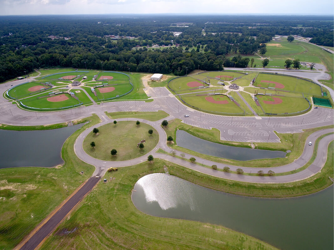
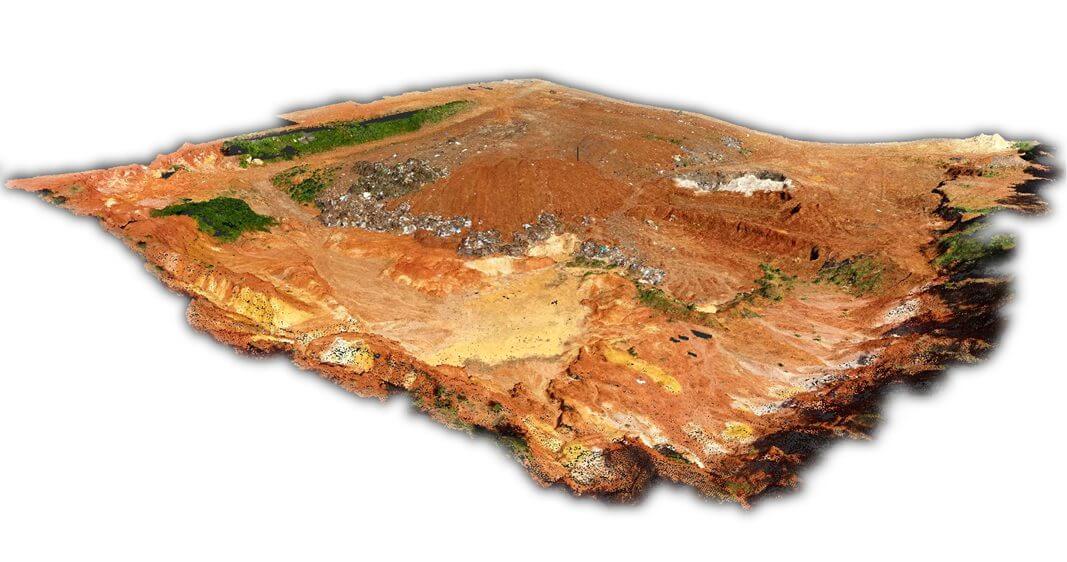
Drones have also been used to provide: an existing grade surface for volume calculations to estimate the amount of debris at an old mill site; planimetric and as-built data for completion of ALTA surveys; existing grade surface for quantity calculations for road construction projects; existing grade surface/as-built surveys for civil site design of new park facilities; and photography and videography to monitor progress at mitigation banks and stream restoration projects, just to name a few.
There is no doubt, we can expect to see this growing trend in more disciplines throughout our industry. Incorporating new technology is how we grow and reach new heights.